
 Orte
Orte Soundwalk 'Designing with the Planet'
by Lucio Telles and Riparian Struggels
As an interdisciplinary urban and spatial researcher, Friederike is fascinated by water as a liquid matter that strongly influences our individual and collective lives as 'bodies of water'. The artistic mapping 'Liquid Matter' consists of various analog stations in Berlin's urban space as well as digital reflections on the role of water in everyday life —water as resource, water as public good, water as threat, water as object of memory, water as art. In the process of selecting spots for the mapping project, Friederike was motivated to highlight infrastructures of water that are sometimes take for granted, or only noticed when they are not working, or failing. Furthermore, Friedrike wanted to underscore the seasonality of water, and its changing forms of accessibility in the public realm. Enjoy your wet explorations of the city!
Prof. Dr. Friederike Landau-Donnelly (*1989, she/her) is a political theorist, urban sociologist, and cultural geographer. She is currently a visiting professor of cultural and social geography at Humboldt University in Berlin and is writing a monograph on conflictual museums in Canada and India. Among other things, she co-edited the handbook Kulturpolitik (2024), Konfliktuelle Kulturpolitik (2023), and [Un]Grounding – Post-Foundational Geographies (2021). Friederike writes poetry as #PoeticAcademic.
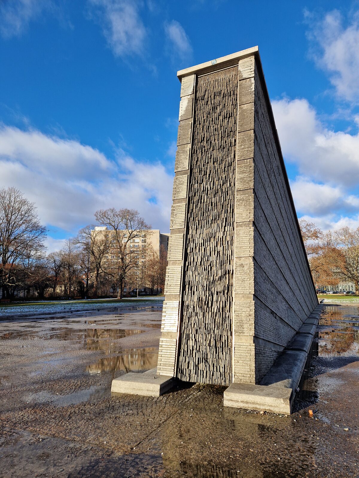
Stop 1: Invalidenpark, 'Sinkende Mauer' - Sinking Border
Location https://www.openstreetmap.org/way/28880840
The name of this monument or ‘sculpture fountain’ in Invalidenpark is “Die Sinkende Mauer”, translating to “Sinking Wall”. The sculpture was designed by Swiss landscape architect and professor Christophe Girot. Installed in 1997, the monument’s official description on the city’s website states that the monument, on the one hand, shall remind of a lost church – the Gnadenkirche (Church of Mercy), also called Invaliden church or Augusta church – which was heavily damaged during and after World War II, and torn down in 1967 by means of blasting in the German Democratic Republic. Interestingly, the Leipzig-based newspaper account as well as the Wikipedia entry for Invaliden park reference the title of the monument as “Versunkene Mauer”, which translates to “Sunken Wall”, indicating more advanced state of decay than the official title, which considers the wall in the process of sinking. Notably, “Mauer”, in German, not only means a designated, separating barrier, but also invokes the Berlin Wall (1961-1989), whose disappearance the monument also commemorates. With regards to flows of water, the experience of this place is utterly seasonal: in the winter, the water basin is almost empty or naturally filled with residue of rain and snow. In the summer, the water basin is full, with water trickling down the tilted wall. When I visited the monument in January of 2025, I did not find an explanatory plaque on-site to provide information on the multiple meanings of the monument. You can walk up and down on it, look down, caress the wall, put your feet in the water. What trickles into your memory? Do you feel the present absence of the Wall just yet?
Do walls mark beginnings or ends?
Is your wall sinking or sunken?
Do walls hurt when they are torn down?
How do walls drown?
Materials have different epistemologies of forgiveness
Water offers itself as generous memorial marking of an ever-returning currency of remembrance
re_membrane
leaky memory
Stop 2: Water plaques in urban everyday life
Location: https://www.openstreetmap.org/relation/9379744
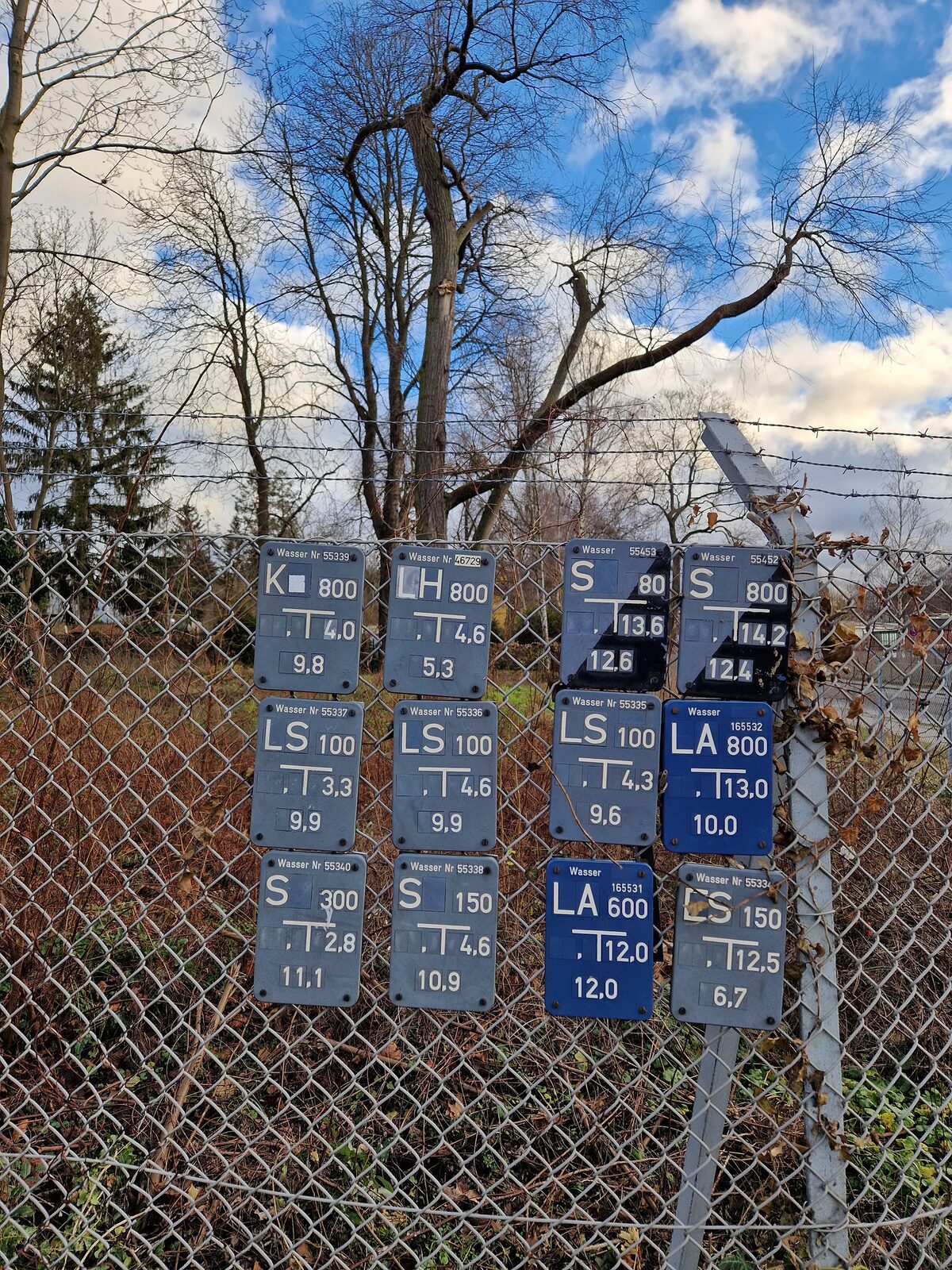
You could measure the city through the distance that lies between each marked intersection of water pipes, indicated by small blue squares. There are millions of such plaques across the city – an alternative map of water metrics flowing through the city. Within each tiny T-shape, you see the distance to the next water pipe (to your left, to your right). The number in the upper right corner indicates the location (on whose map?). Red-white plaques tell you where the next hydrant is, green plaques mark the pressurized sewage regulators. It is a huge mapping project we barely notice in everyday life.

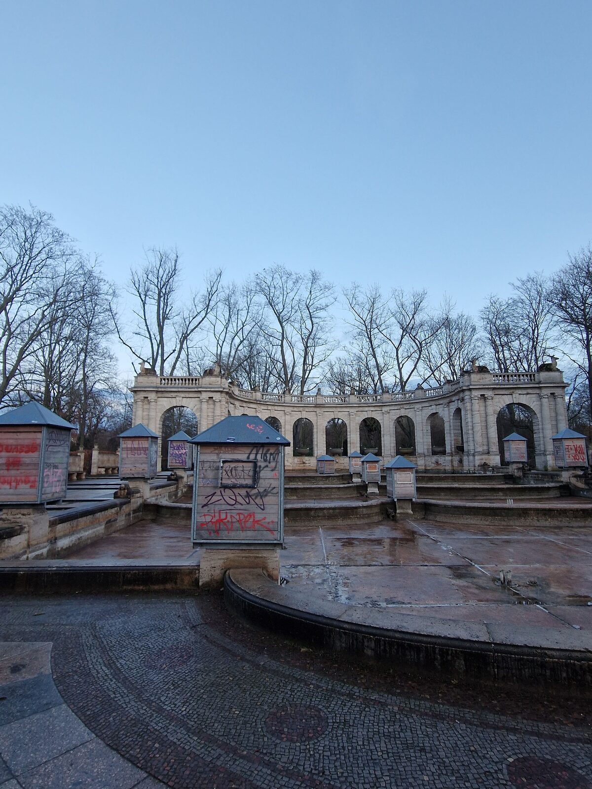
Stop 3: Drinking fountain in Volkspark Friedrichshain, Märchenbrunnen
Location: Weg: Fontaine des contes de fée (450882982) | OpenStreetMap
There are over 200 drinking foundations in Berlin, scattered unevenly across the 12 boroughs. From this impressive amount of drinking foundations, about 10 percent of them are wheelchair-accessible. Besides this not systematically accessible starting point, another curious fact that stands out is that the publicly-serviced drinking fountains are in so-called winter sleep: Formally, drinking fountains are operated between May and October, and dormant between November and April. While natural reasons such as temperature drops and the concomitant sensitivity of pipes are comprehensible, the notion of water as a public good slightly clashes with the uninterrupted provision of water to Berliners. What if you do not have constant access to clean (drinking) water? Who does the City imagine to ‘need’ these? There are initiatives such as Refill Germany, posting stickers on cafés and restaurants to offer free refill on tap water.
As per German Federal Drinking Water Decree, a 70-page document outlining rules, regulations and mechanisms of monitoring quality, risk, distribution and testing, water in Germany (is it German water?) has to be unobtrusive with regards to taste, color and small. Neutrality of taste? Tastelessness as a goal?

Stop 4: An incomplete manifesto for the Sponge City
Location: Knoten: Gleisdreieck (2102139395) | OpenStreetMap
#1: The whole city is constantly under pressure – release it.
#2: The total balance of water in the city is always zero – the total balance of water in the city shall always be one hundred.
#3: Unseal the city – open the city up to its original surfaces which are naturally porous.
#4: Let the city breathe again, leak again – for endless new constellations of more-than-human justice to evolve.
#5: Reverse containment – liberate the city from its own concrete violence.
#6: Become permeable = sink in = breathe out = evaporate = elevate
Following the notion of the city as a sponge, or sponge city, the goal for the unobstructed circulation of water is to absorb rainwater and release it when- and wherever needed. In the sponge city, rainwater is saved where it is received and released into the natural circuit of water (instead of being channeled towards the sewage system). A shift in paradigm led to the foundation of the so-called Regenwasseragentur (Rainwater Agency) in 2018, a consultation agency that advocates and implements measures for the unsealing of urban surfaces (more than a third of Berlin’s urban surfaces are currently cemented or otherwise sealed). For new buildings and construction, the principle of the sponge city needs to be respected and implemented. Even though aspirations are to build “in the spirit of the sponge city are institutionalized, it will take generations to unseal the city whilst also adding more green surfaces such as rooftops, facades, streets and (back)yards to urban space. can support the process of evaporation, to help cool the city, and prevent so-called (urban) ‘heat islands’.

Stop 5: Denkzeichen des Berliner Wassersports e.V.
Location: https://www.openstreetmap.org/way/1052798591
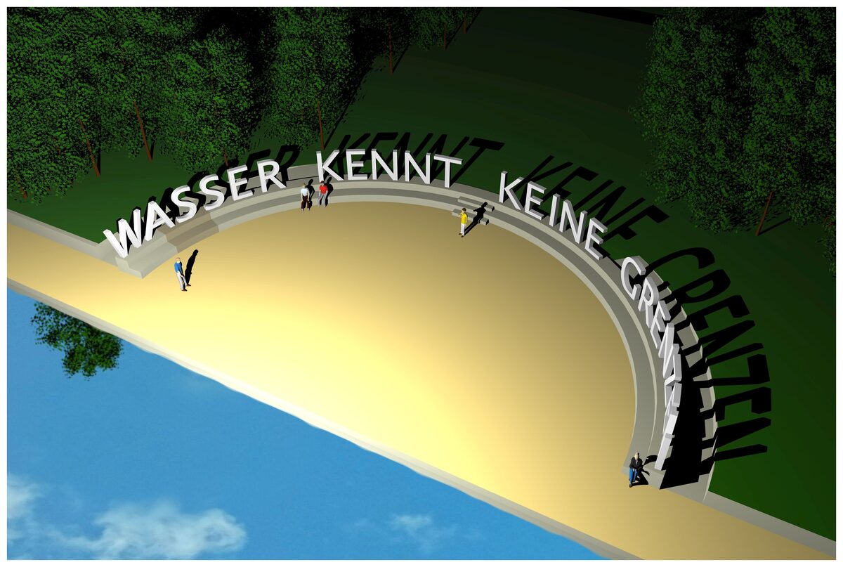
There is another, less well-known water-related monument in the City of Berlin, more precisely, in the south-Eastern area of Berlin-Grünau. While the monument is not formally designated as monument on official city maps, civil activists have been advocating for a resurrection of the monument, which would integrate remains of the original monument, since 1990. The original monument to German watersports was built in 1898 and torn down in 1973 during the German Democratic Republic (GDR). The association Grünau-Initiative Denkzeichen des Berliner Wassersport e. V. (Monument Water Sports) was founded in 2012 and has changed its organizational form as registered association various times. In 2016, the initiative was awarded 300.000 Euros from the German Lottery Foundation to erect a monument. Whilst multiple other drafts for the monument design had existed beforehand, the lottery foundation asked the association to initiate an open call, which, in 2017, commissioned artists Maria Vill und David Mannstein with a monument proposal that carries the slogan “Wasser kennt keine Grenzen“ (Water knows no borders). In comparison with the official water monument (see Stop 1), this monument underscores relationality, integration, fleetingness. The location of the Platz am Sportdenkmal in Grünau highlights the uniting force of sports.
Stop 6: Seestraße, between Guineastr and Cornelius-Fredericks-Str
Stop 7: water recycling & treatment cycles
Location: Weg: Wasserwerk Johannisthal (743681572) | OpenStreetMap
Berlin's tap water, which we use for everyday activities such as showering, washing up and drinking, is provided from groundwater. Around 30% of this groundwater consists of infiltrated rainwater, 70% of so-called “(river) bank filtration” – i.e., water from the rivers Spree and Havel, which is drawn underground by the suction of deep wells, managed by the city-operated Berliner Wasserwerke, in processes of purification which can last weeks and months. Only iron and manganese are removed from the groundwater, while the natural minerals of magnesium and lime remain in the water. After use, the water is purified in one of Berlin's six sewage treatment plants and fed back into the rivers. Some of this water is returned to the bank filtration system. The Berlin Brandenburg region, which is characterized as a “water-rich but water-poor region”, is dependent on high water quality due to this comparatively tightly enclosed water cycle. The Berliner Wasserbetriebe therefore relies heavily on further increasing the purification capacity in the sewage treatment plants, but also on the “sponge city” principle (see stop 4). After all, the metropolis of Berlin can hardly live on its rivers alone, because “the Spree and Havel don't really deserve the name river due to their low water flow,” says Stephan Natz, press spokesperson for Berliner Wasserbetriebe.
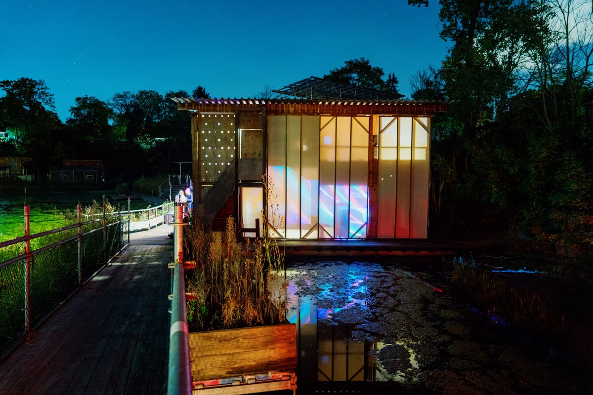
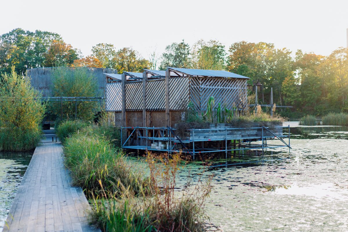
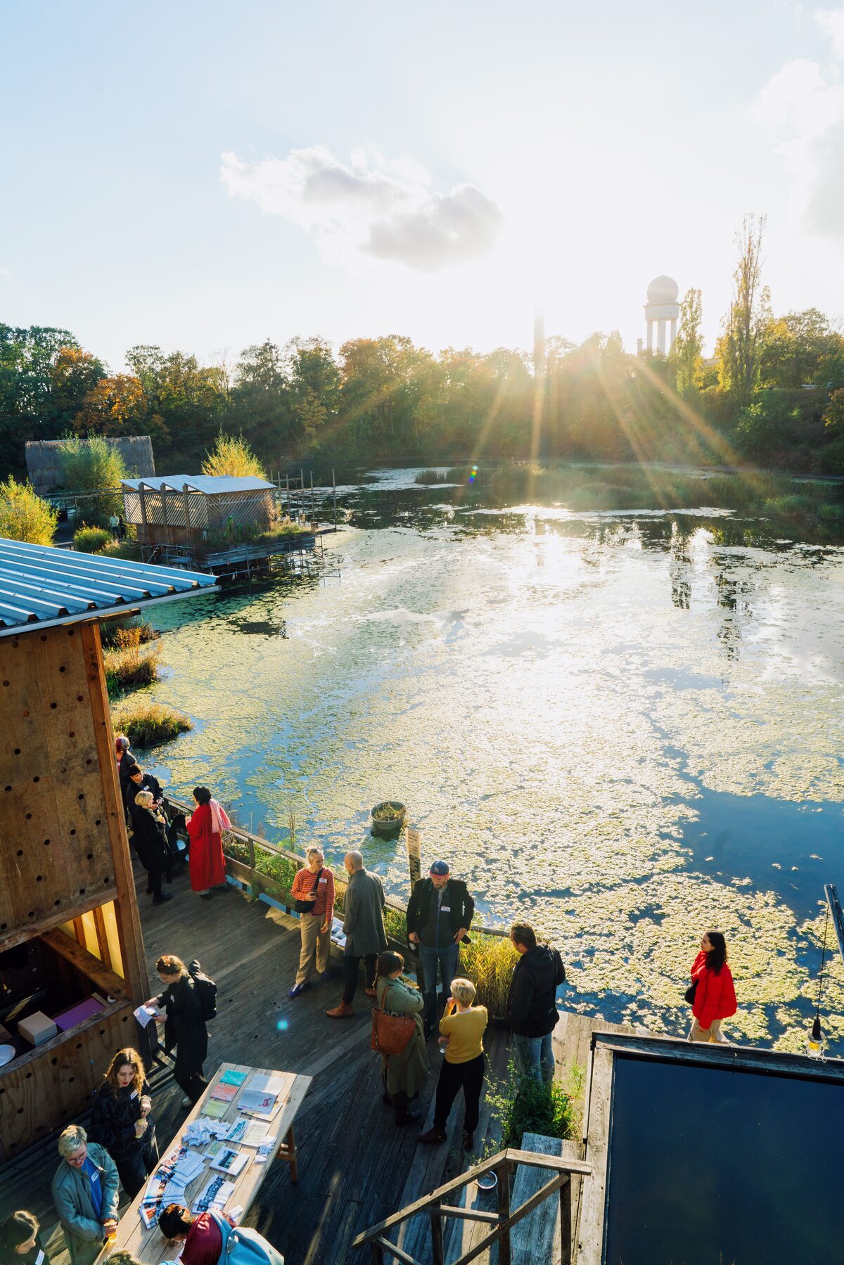
Stop 8: Floating University, rainwater retention pool // waiting for paragraph
Location: Knoten: floating berlin (9723441190) | OpenStreetMap
Stop 9: Bärenzwinger, kommunale Galerie Berlin-Mitte
Location: Knoten: Bärenzwinger (9553980268) | OpenStreetMap
The waters of the art world are unfathomable. Yet, art worlds are increasingly interested in discussing the confluences between art, space, and matters. The exhibition text for “By Way of Water”, curated by Annika Reketat and Cleo Wächter at Bärenzwinger Berlin from August 2 to October 13, 2024, states: “As beings whose bodies consist largely of water, there is no fixed boundary between us humans and this element. And yet we often perceive it as something alienating rather than unifying.” Come to the waters with us…
Stop 10: waterismilkiswater
Location: Knoten: Collemacchia (9278428122) | OpenStreetMap
Stop 11: Wassergerechtigkeit/-konflikt Podcast Henriette Schubert-Zunker
Location: Relation: Technische Universität Berlin (1273140) | OpenStreetMap
x-Student Research Groups: Streit um Wasser in Deutschland - TU Berlin